Maumee River
Boat launchs
Grand Rapids Ohio
Toledo Ohio
Rossford, OH
Perrysburg, Ohio
Napoleon, OH
|
Origin |
Fort Wayne by the confluence of the St. Joseph and St. Marys. |
|
Mouth |
Lake Erie at Toledo |
|
Basincountries |
USA |
|
Length |
137 miles (220 km) |
|
Sourceelevation |
750 ft (229 m) |
|
Mouth elevation |
571 ft (174 m) |
|
Avg.discharge |
5,297 ft³/s (150 m³/s) |
|
Basin area |
6,354 mi² (16,458 km²) |
The mouth of the river at Lake Erie is wide and supports considerable commercial traffic, including oil, grain, and coal. However, about 12 miles (19 km) upstream, in the town of Perrysburg, Ohio, the river becomes much shallower and supports only recreational navigation above that point. The abandoned Miami and Erie Canal paralleled the Maumee between Defiance, Ohio and Toledo; portions of its towpath are currently maintained for recreational use. The Wabash and Erie Canal continued on from Defiance to Fort Wayne, crossing the "summit" to the Wabash River valley. Both were important pre-railway transportation methods in the 1840-60 period. The Miami and Erie was north of the river, until it crossed an aqueduct and turned south at Defiance, headed for Cincinnati. The Wabash canal was south of the Maumee until it reached Fort Wayne.
The Maumee has the largest watershed of any Great Lakes river with 8,316 square miles (21,540 km2). Its watershed includes a portion of southern Michigan. In addition to its source tributaries the St. Joseph and St. Marys rivers, the Maumee's principal tributaries are the Auglaize River and the Tiffin River, which join it at Defiance from the south and north, respectively.
Our Favorit places to ride on the Maumee River
MaumeeWake members prefer a section of the river above the Providence damn between the towns of Grand Rapids and Napoleon. This section of the river is wide with high banks and large trees growing along the river. It also has several bends in it. The tree growth and bends help keep the water surface smooth and even on a windy day you can find some water sutable for riding. Access to the river in this section of the river is provided via Mary Jane Thurston State Park
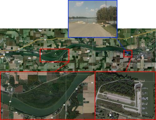
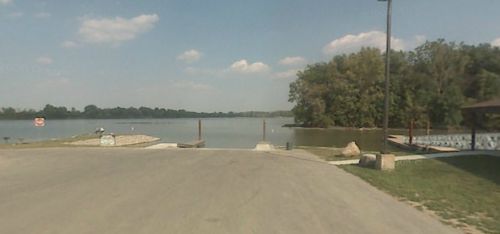
This state park covers a large area of the river and its banks. The state operates a marina in the park with a free double wide public launch, small conviance store and floating dockage and slips. Slips can be rented by the night or for the season.
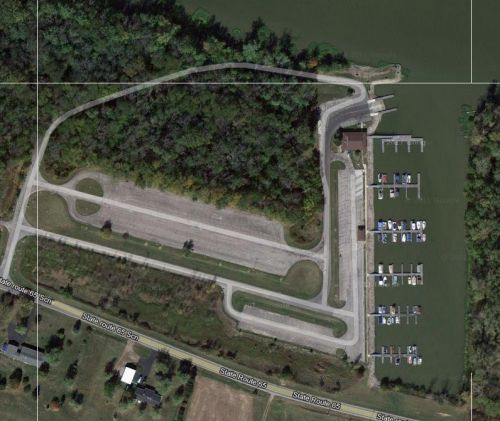
Riding Hot SPOT!
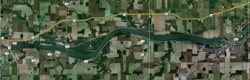
The section of river that intersects Turkey Foot Creek is a hot spot during the riding season. This section of river has limited residential property and on the north bank the river is completely wooded park area. The river is nice and wide in this area allowing plenty of space even when boating traffic is high. The local boating community is aware that this area is a favorite for wake sports and they keep aware and watch out for riders, they also tend to keep other water sports such as tubing and skiing in other areas. People tend to navigate this area of the river in a particular manner, this helps keep the area safe and less congested. The through traffic will stay to the center of the river but when towing riders boaters will hug the shore lines, the river bottom is very flat with an even depth of about 8-13ft until about 20ft from sore.
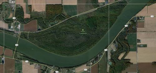
The typical pattern when towing a rider would be to follow the north shore west, make a tight turn and follow the same path back east or follow the south shore east make a tight turn and follow your same path back west. This pattern provides approximately a 2 mile course with one pass. It is quickly observed that wind direction and speed will dictate were most boaters will make their turn and in high wind situation only one of the two shore lines will have a ride worthy water surface, so it is important to keep a sharp eye when traffic is high. It is also frowned on to take power turns when your riders falls, you should slow you boat to ideal and take a slow turn back to your rider to prevent sending waves the length of the river. These waves can cause a hazard to other riders and it causes the water’s surface to get very choppy.

More information: